Hill walk
routes to climb in SW Scotland - also coastal paths and National Scenic
Areas with maps, pictures and other useful information based on extensive
local knowledge
St
Ninian's Cave to Isle of Whithorn
Click on
the left side of the image below to go back to the previous page
or, on the right side of it to go to the next page.
or, on the right side of it to go to the next page.
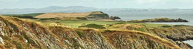
I have in the first picture below zoomed into the above picture so that you can see the white tower on the finger of land you that reaches out from "the Isle" This is possibly the Isle's most familiar landmark and it has been a navigational aid for hundreds of years. From here there are spectacular views of the Kirkcudbright (pronounced kirkoobry) coast, and the whole of the northern range of the English Lake District mountains. To the south can be seen the rounded, mountainous form of the Isle of Man. During the Second World War this was the site of a tracking station for anti-aircraft gunnery practice.
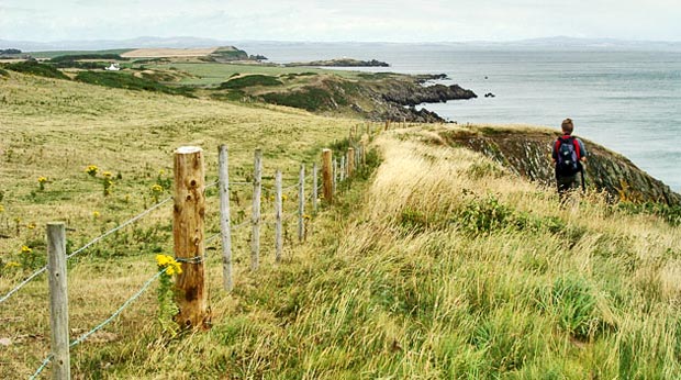
In the third picture we have now gone beyond the last of the high cliffs and you can see how the route now follows the edge of fenced fields and drops steadily down towards the Isle.