| Hill walk
routes to climb in SW Scotland - also coastal paths and National Scenic
Areas with maps, pictures and other useful information based on extensive
local knowledge |
| Mull
of Galloway |
| |
| Click on
the left side of the image below to go back to the previous page
or, on the right side of it to go to the next page. |
| |
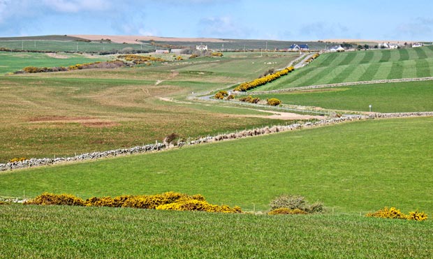
| 09 The picture above shows the gently undulating
plateau which runs down the centre of Rhins of Galloway and you can see
the road making it's way north towards Stranraer.
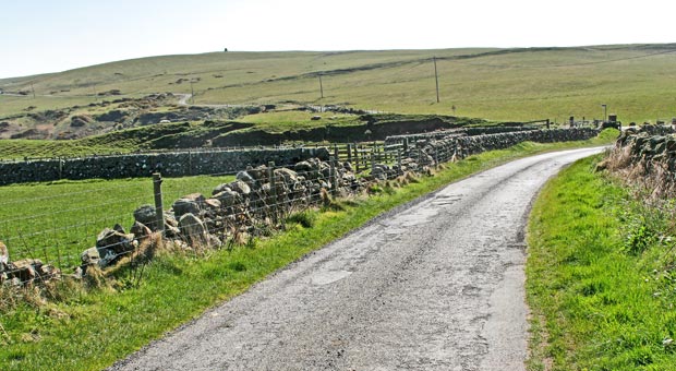
The picture below shows the same road heading south to the Mull and that
is how the route now takes us - all the way back to the lighthouse. It was
12.49 (according to my camera) when this picture was taken and we were concerned
that we might not be able to get some lunch at the tearoom by the lighthouse
if we did not make a beeline for it. We could have just crossed onto another
off-road track when we came up from the Kirk Burn onto the road, and even
when we were nearer the lighthouse we could have made our way along the
path on the north coast of the Mull, but the novelty of being able to have
a Guinness, some soup and some chips in the middle of our day's walk was
just too much for us - we just followed the tarred road back past where
the car was parked and I unloaded the stones from my pack in the passing. |
 |
| |
|
|
|
 |
|
|
|
|
|