Hill walk
routes to climb in SW Scotland - also coastal paths and National Scenic
Areas with maps, pictures and other useful information based on extensive
local knowledge
Mull
of Galloway
Click on
the left side of the image below to go back to the previous page
or, on the right side of it to go to the next page.
or, on the right side of it to go to the next page.
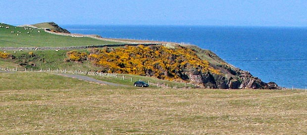
The picture below was taken much later in the day as we made our way back to the car. It shows the view north and the early part of our route towards Portankill on the east shore of the Rhins of Galloway. The route is way-marked for walkers. Notice the mass of whins (gorse) along the north side of the bay and for that matter in several other places on the route as you will see.