Hill walk routes to climb in SW Scotland
- also coastal paths and National Scenic Areas with maps, pictures and
other useful information based on extensive local knowledge
Mull of Galloway
Map of a figure of eight
coastal walk to the lighthouse and Royal Society for the Protection of
Birds visitor centre at the end of the Mull of Galloway
Click on the left side of
the image below to go back to the previous page
or, on the right side of it to go to the next page.
or, on the right side of it to go to the next page.
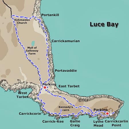
01 This walk is done as a figure of eight starting from the parking place shown near East Tarbet Bay. Parking here by the single track roadside is limited but there is a proper parking area down by the lighthouse near Carrickcarlin Point. There is plenty of good easy walking around the lighthouse area among spectacular scenery as you will see.
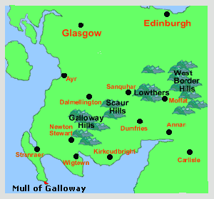
The Mull of Galloway is the most southerly point in Scotland and is in fact further south than Carlisle and Newcastle - see the small map on the right - on a level with Penrith in fact and almost on a level with the mouth of the Tees on England's east coast.
We walked northwards up the east coast
of the the Rhins of Galloway peninsula - to Portankill, tried to find
the remains of Kirkmaiden Church then made our way all the way along the
tarred road to the lighthouse, where we had lunch in the tearoom there,
and then visited the visitor's centre before heading west along by Gallie
Craig, Kennedy's Cairn and West Tarbet to our car.