Hill walk
routes to climb in SW Scotland - also coastal paths and National Scenic
Areas with maps, pictures and other useful information based on extensive
local knowledge
Steygail,
Wether Hill, Lowther Hill and the Enterkin Pass
Click on
the left side of the image below to go back to the previous page
or, on the right side of it to go to the next page.
or, on the right side of it to go to the next page.
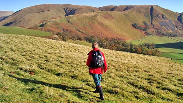
Steygail is ahead of us in the left half of the picture above and we are looking North East. You can see how the top loops round anti-clockwise as it ascends. The valley that we are looking into is the Dalveen Pass along which runs the A702 from the A76 at Carronbridge just north of Thornhill in Dumfriesshire to Elvanfoot by the M74 in Lanarkshire.
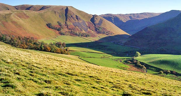
In the picture below we are looking North West. You can see what a fascinating shape Steygail is - like an animal at rest curled in a ball with it's tail towards us - and you can see that our route up onto it from here is a simple, steady climb which will be rewarded all the time with views over the Dalveen Pass to the Durisdeer hills on the other side of the valley. The small river in the valley is called the Carron Water.
You can just see the ball on the top of Lowther Hill (to which we are heading) at the left edge of the picture.
At this stage we are walking along a very pleasant low ridge which stands between the valleys of the Carron and Enterkin Waters. The line of trees that you see running up onto our ridge comes up from Dalveen House (just visible at the edge of the trees) and there is a track over from there onto the old bridle route to the Enterkin Pass that we saw on Page 01. It is worth wandering from side to side of this low ridge as you go along - to get views into both the Carron and the Enterkin valleys.