Durisdeer
Hills and Dalveen Pass
Click on the left side of
the image below to go back to the previous page
or, on the right side of it to go to the next page.
or, on the right side of it to go to the next page.
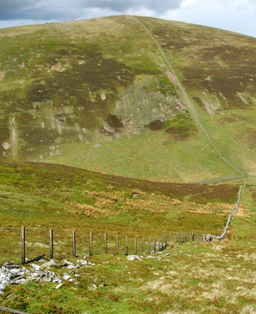
The Potrail Water originates from various wee burns around the North and East sides of Durisdeer Hill and heads North East to meet Daer Water near Glenochar by the A702 (OS Ref. NS955137), where these conjoined waters become the River Clyde. So what you are looking at down there in the valley in the picture above is one of the sources of the River Clyde. Click here for further discussion of this.
That is in fact the watershed between the systems of the River Nith and the River Clyde down there. The water running left out of this picture goes down into the Nith, past the town of Dumfries and out into the Solway Firth; the water running right runs up past Glasgow and out into the Firth of Clyde.