| Cairnkinna
Round |
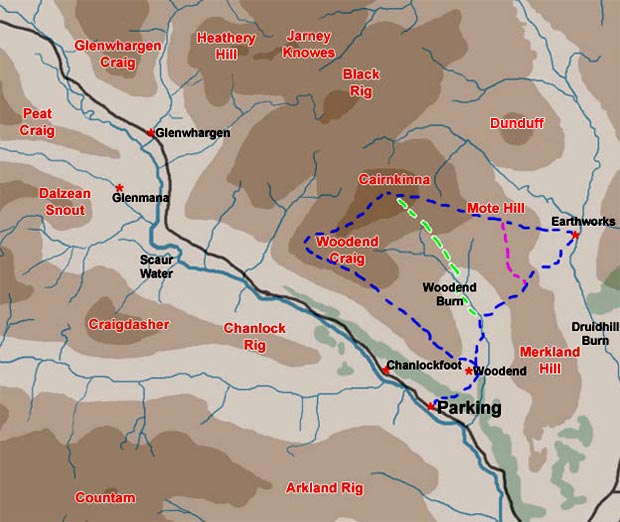
| Map of
a short circular hill walking route from the Scaur Water near Woodend
over Woodend Craig to Cairnkinna, returning by Mote Hill and the earthwork
on Druidhill Burn |
| Click on the left side
of the image to go back to the previous image and on the right side
of the images to go to the next image |
|
| 01 This is a quite easy walk which
can be made shorter or longer as you desire. |