| Portpatrick
Round via Killantringan |
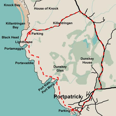
| Map of a
circular coastal walk from Portpatrick along the Southern Upland Way to
Killantringan Bay in the Rhinns of Galloway |
| |
| Click on the left side
of the image to go back to the previous image and on the right side of
the images to go to the next image. |
| |
| 01 This is an easy walk of around 9 kilometers starting
from the harbour in Portpatrick
(NW996542). It goes up through the town, turning left at the outskirts onto
the Leswalt
road and then left again when you come to the road that goes down to Killantringan
lighthouse. All this is on public road. Thereafter you follow the path
of the Southern
Upland Way back to Portpatrick. Some parts around Port Kale and Port
Mora involve a little scrambling through rocks but chains have been put
here to help you up or down the tricky bits. You could walk just from Portpatrick
to the lighthouse - or park at the lighthouse and walk the other way if
you want a short walk. There is a tearoom at Dunskey
House and a path down Dunskey Glen which offer further possibilities.
Portpatrick itself offers a good choice of places to eat and drink. |