|
Hill walk routes to climb in SW Scotland
- also coastal paths and National Scenic Areas with maps, pictures and
other useful information based on extensive local knowledge
|
|
Mull of Galloway
|
|
|
|
Click on the left side of
the image below to go back to the previous page
or, on the right side of it to go to the next page.
|
|
|
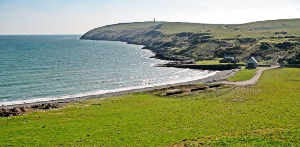
| 04 Here we are again looking east towards
the lighthouse. You can see the single track road running up to it along
the top of the peninsula and you can see how the land drops sharply down
to the sea from the undulating plateau on the top. Notice in the map that
the Mull itself takes a real hook to the east whereas the rest of the Rhins
of Galloway peninsula runs more or less north-south. So this is really the
north shore of the Mull and the drop down to the sea is more gentle and
less spectacular on the north coast than it is on the south of the Mull. |