Durisdeer
Hills and Dalveen Pass
Click on the left side of
the image below to go back to the previous page
or, on the right side of it to go to the next page.
or, on the right side of it to go to the next page.
|
Durisdeer
Hills and Dalveen Pass
|
|||
|
Click on the left side of
the image below to go back to the previous page
or, on the right side of it to go to the next page. |
|||
|
|
|||
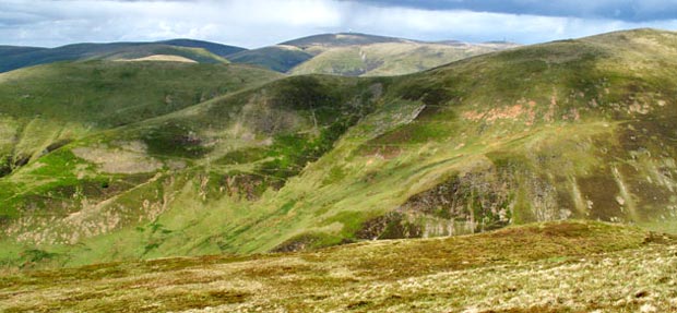
| 27 That's Well Hill at the right of this picture as you can see there would be a fair bit of descent from Well Hill and re-ascent onto Penbane if you had taken that route off the top of Well Hill (the green route on Page 01). That's Capel Hill that you see on the left and of course Lowther Hill in the middle of the picture with East Mount Lowther (or Auchenlone) to it's left. |