Durisdeer Hills and Dalveen Pass
Map of the area - List of Lowther Pages - Durisdeer and Dalveen Home - Site Homepage
Click on the left side of the image below to go back to the previous page
or, on the right side of it to go to the next page.
View back down to Durisdeer village as we climb Castle Hill View back down to Durisdeer village as we climb Castle Hill View back down to Durisdeer village as we climb Castle Hill
04 The picture above shows the view back down to Durisdeer village as we make our way from the village to the start of the route up onto Castle Hill. The red asterisk shows where the gate is that you go through to get down to the Kirk Burn, and the blue asterisk shows where there is a new concrete bridge over the Kirk Burn - which is handy after heavy rain. East Morton Hill lies beyond the village in this picture.
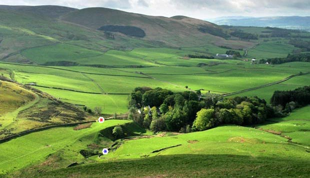
The picture below shows the view of the same scene but from Durisdeer Rig - the gate and the bridge are again marked with their asterisks and you can see the vehicle track heading off towards the bottom right of the picture on it's way from Durisdeer to Troloss. You could return by this track if you wanted an escape route after descending Well Hill later in the day - see the red route on the map on page 01.
View back down to Durisdeer village from Durisdeer Rig
Go to page 03
Go to page 05
Map of the area - List of Lowther Pages - Durisdeer and Dalveen Home - Site Homepage