|
Hill walk routes to climb in SW Scotland
- also coastal paths and National Scenic Areas with maps, pictures and
other useful information based on extensive local knowledge
|
|
Bodesbeck Ridge
|
|
|
|
Click on the left side of
the image below to go back to the previous page
or, on the right side of it to go to the next page.
|
|
|
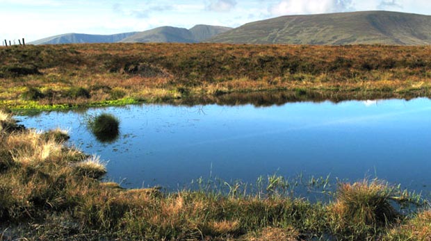
| 08 Now we are on the top of the ridge, past
the top of Andrewhinney and heading SE towards Bell Craig. There is quite
a sizeable shoulder on Andrewhinney before you descend from it into the
dip between it and Bell Craig. On the Ordnance Survey Explorer Map this
shoulder is called Scawd Law. There are one or two small lochans on the
flat top of Scawd Law as you see above. We are now beginning to see the
tops of Swatte Fell and Saddle Yoke beyond White Coomb. The fence that you
can see on the left is the boundary fence between the two Scottish Regions
of "Dumfries and Galloway" and the "Borders". The Scots
word "Scawd" means that the land has bare brown patches on it. |
 |
|
|
|
|
|